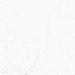
Кърджали | Kardzhali
Most travellers come for the landscapes around town rather than the town itself, Perperikon's rock-cut temple complex, the Devil's Bridge spanning a gorge of the Arda, and the Stone Wedding's eerie pink pillars are all within easy day-trip range. The Regional History Museum holds Thracian gold finds, and the reservoir lakes draw kayakers in warm months. Kardzhali also makes a good base for exploring the wild eastern Rhodopes, one of Bulgaria's least-touristed mountain ranges.
Do not visit Kardzhali expecting every worthwhile stop to be close together or easy to improvise. In Kardzhali, opening hours, transport, weather, crowds, and distance can shape the day more than the list of sights. For Kardzhali, group stops tightly, verify hours, and use a ride when transit, darkness, or neighborhood conditions make that wiser. If the main interest is one nearby site, it may be better to treat Kardzhali as a base rather than the whole destination.
Current conditions and the practical reference material that helps turn the saved places into a trip.
7-day forecast from Open-Meteo. UV badges flag days when sun protection matters (3 and above is moderate; 8 and above is risk territory for unprotected fair skin within 30 minutes).
Typical highs around 29°C, lows around 16°C. The drier end of the year.
Typical highs around 8°C, lows around -1°C. Most of the year’s greyest, wettest weeks.
Public holidays from Nager.Date.
Public-transit operators within 8 km of the city center. Click through to each operator’s site for routes, fares, and tickets.
Operators and modes are aggregated from individual transit-agency GTFS feeds. Route classifications come from each feed’s route type codes.
Kardzhali, sometimes spelt Kardžali or Kurdzhali, is a town in the Eastern Rhodopes in Bulgaria, centre of Kardzhali Municipality and Kardzhali Province. The noted Kardzhali Reservoir is located nearby. It is an important regional economic hub.
The links below support the changing or licensed reference material on this page. Personal notes and ordinary geographic facts are not footnoted individually.
Monthly highs, lows, rainfall — long-term averages, NASA POWER.
Maps, image licenses, and the full dataset registry are listed in site credits.