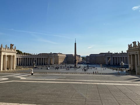
Vatican City, a city of spiritual and physical pathways, inviting introspection in the midst of busy Rome.
Vatican City is tiny but travel-relevant because the museums, St. Peter's, the square, and nearby Prati food stops can fill a full Rome day. It needs timed entry and patience more than a long checklist.
Do not treat Vatican City as a place where the important stops automatically line up in one walk. In Vatican City, do the practical checks before the day is fixed: opening days, tickets, transport frequency, and distances between areas. Do not let the map of Vatican City make the route look simpler than it is. This keeps the day flexible when transport, weather, or opening hours change.
Current conditions and the practical reference material that helps turn the saved places into a trip.
7-day forecast from Open-Meteo. UV badges flag days when sun protection matters (3 and above is moderate; 8 and above is risk territory for unprotected fair skin within 30 minutes).
About 74% of the year's rain falls in these months. Typical highs around 16°C, lows around 8°C.
Typical highs around 27°C, lows around 16°C. About 40mm of rain a month.
Public holidays from Nager.Date.
Public-transit operators within 8 km of the city center. Click through to each operator’s site for routes, fares, and tickets.
Vatican City, officially the Vatican City State, often shortened as the Vatican, is a landlocked sovereign city-state. Ruled by the pope, it is an enclave within the city of Rome, Italy, and serves as the administrative centre of the Catholic Church. Vatican City is governed by the See of Rome, commonly known as the Holy See, itself a sovereign entity under international law, which maintains its temporal power, governance, diplomacy, and spiritual independence. Vatican is also used as a metonym for the Holy See, which is the central governing body of the Catholic Church and Vatican City, comprising the pope and the Roman Curia. The independent state of Vatican City came into existence in 1929 via the Lateran Treaty between the Holy See and the Kingdom of Italy, which spoke of it as a creat
The links below support the changing or licensed reference material on this page. Personal notes and ordinary geographic facts are not footnoted individually.
Monthly highs, lows, rainfall — long-term averages, NASA POWER.
Operators and modes are aggregated from individual transit-agency GTFS feeds. Route classifications come from each feed’s route type codes.
Maps, image licenses, and the full dataset registry are listed in site credits.