🗂️Guides🏙️Cities📮Pins🌍Countries🚇Getting Around📍My lists😻Cats📖About
Everything else
🏠Home🔐Privacy & data📜Terms of use🧾Sources & credits⛷️Cat-Ski↗ (opens in a new tab)👤Whisker Leaks↗ (opens in a new tab)
🗂️Guides🏙️Cities📮Pins🌍Countries🚇Getting Around📍My lists😻Cats📖About
Everything else
🏠Home🔐Privacy & data📜Terms of use🧾Sources & credits⛷️Cat-Ski↗ (opens in a new tab)👤Whisker Leaks↗ (opens in a new tab)
PostcardsMapTableStats

Plan Boston

Current conditions and the practical reference material that helps turn the saved places into a trip.

The next week in Boston

7-day forecast from Open-Meteo. UV badges flag days when sun protection matters (3 and above is moderate; 8 and above is risk territory for unprotected fair skin within 30 minutes).

Today
Partly cloudy
29° / 17°
UV High
Wed
Overcast
30° / 17°
UV High
Thu
Drizzle
30° / 22°
1.6 mm
UV High
Fri
Drizzle
32° / 23°
UV High
Sat
Showers
32° / 22°
5.5 mm
UV High
Sun
Overcast
29° / 21°
UV High
Mon
Overcast
33° / 24°
UV High

Climate

Summer (Jun-Sep)

Typical highs around 26°C, lows around 15°C.

Winter (Dec-Mar)

Typical highs around 3°C, lows around -5°C.

In August 4

Drag to scrub across the year.

JFMAMJJASOND
Weather
27° / 17°
Typical high / low
3 mm rainfall this month
Daylight
14.0h
05:50 – 19:47local
Holidays coming up

Public holidays from Nager.Date.

Airports

closest BOS · 4 km

Getting around Boston

Public-transit operators within 8 km of the city center. Click through to each operator’s site for routes, fares, and tickets.

Local transit operators
Amtrak↗ (opens in a new tab)Yankee Line↗ (opens in a new tab)Logan Express↗ (opens in a new tab)Massport↗ (opens in a new tab)128 Business Council↗ (opens in a new tab)VIA Rail↗

About Boston

Boston is the capital and most populous city of the U.S. state of Massachusetts. It serves as a cultural and financial center of New England, a region of the Northeastern United States. Boston has an area of 48.4 sq mi (125 km2) and a population of 675,647 as of the 2020 census, making it the third-most populous city in the Northeastern United States after New York City and Philadelphia. The larger Greater Boston metropolitan statistical area had a population of 4.9 million in 2023, making it the largest metropolitan area in New England and the eleventh-largest in the United States.

Area
232 km²
Demonym
Bostonian
Mayor
Michelle Wu
Airport codes
BOS, ZTO
United States of America basics →Country context, advisories, and entry links for the practicalities shown above.
References5▾▴

The links below support the changing or licensed reference material on this page. Personal notes and ordinary geographic facts are not footnoted individually.

  1. City background. Wikipedia summary may be clipped or paraphrased. Structured fields are cross-checked against the related references.
JFMAMJJASOND30°-10°
highlowrainfallcomfortable months

Monthly highs, lows, rainfall — long-term averages, NASA POWER.

(opens in a new tab)
Greyhound↗ (opens in a new tab)
Middlesex 3 TMA↗ (opens in a new tab)
Bloom Bus
Blue Apple Bus Company
Train de Charlevoix↗ (opens in a new tab)
Cape Cod Regional Transit Authority
MBTA
Boston Express↗ (opens in a new tab)
Boston Harbor Islands National and State Park↗ (opens in a new tab)
Harvard University
Avalon Shuttle
Academy Bus↗ (opens in a new tab)
Flixbus↗ (opens in a new tab)

Operators and modes are aggregated from individual transit-agency GTFS feeds. Route classifications come from each feed’s route type codes.

Related: Wikidata, Open-Elevation, IANA Time Zone Database, CC BY-SA 4.0.
  • Weather and climate. Seven-day forecast and long-term monthly climate for the city coordinates. Related: NASA POWER, Open-Meteo license.
  • Getting around. Transit operators from agency GTFS feeds and nearby commercial-airport reference data. Related: OurAirports.
  • Public holidays. Upcoming public-holiday dates used in the annual planning scrubber.
  • City flag source. Public domain, Svgalbertian.
  • Maps, image licenses, and the full dataset registry are listed in site credits.

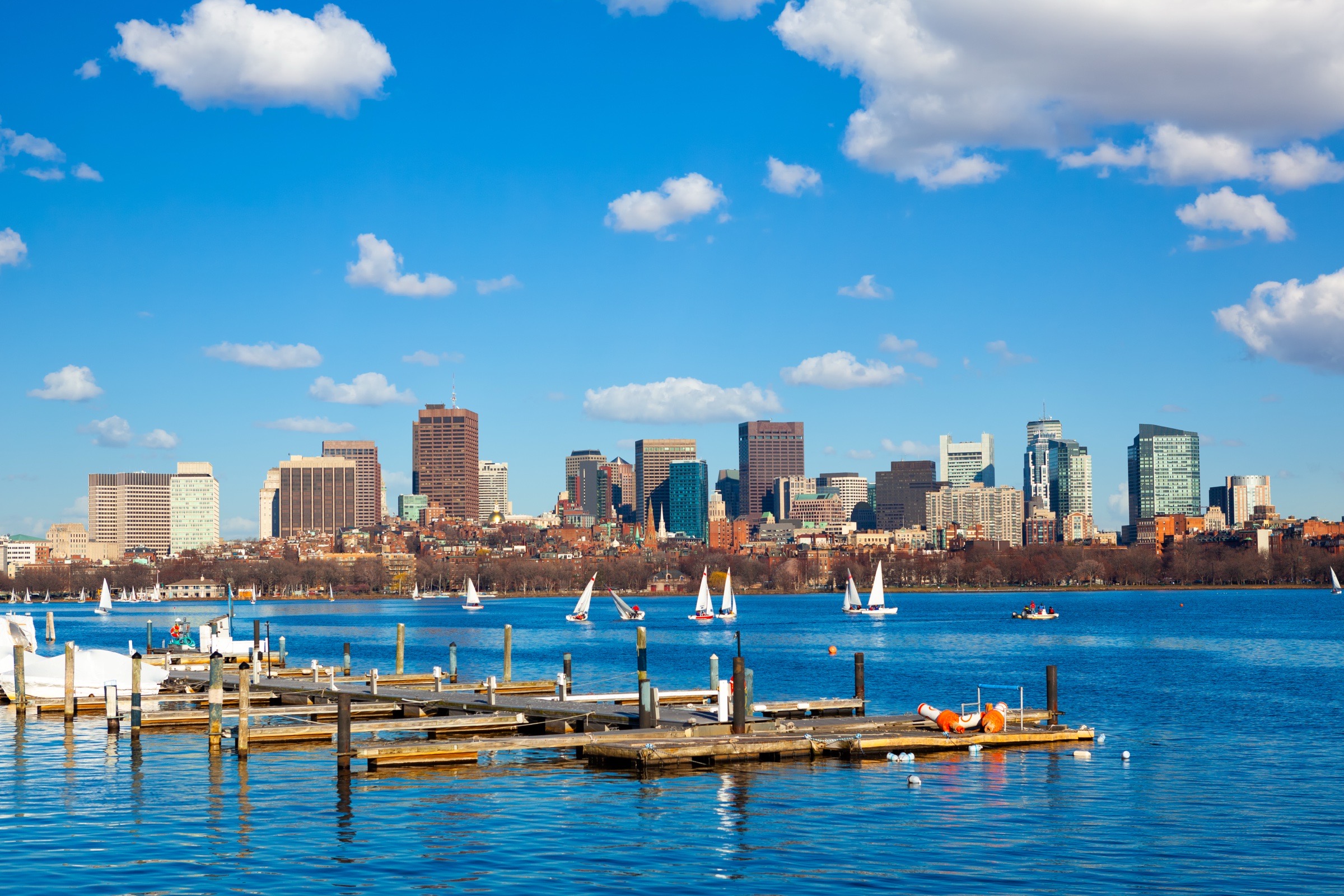
    Boston skyline over the Charles River.
    Cities›United States of America›Boston

    Boston, the walkable end of the Freedom Trail

    A Boston list for Faneuil Hall Marketplace, the Freedom Trail, the North End, and the waterfront.

    Updated
    Jul 2, 2026
    ◎Things to do in Boston→🚇MBTA Subway guide→
    BeenDfa📍1 places

    Boston at a glance

    Local time   · America/New_York
    Today
    Partly cloudy29° / 17°
    Travel basics
    Tap water
    Safe to drink
    Electricity
    120V/60Hz · Type A / B
    Drives on
    Right
    Currency
    USD $
    Language
    English
    US passport
    N/A

    Entry rules change. Verify current requirements before booking.

    City context
    Population
    676K
    Elevation
    43 m
    Climate
    Dfa
    Founded
    1630
    United States of America
    On this page
    • What's on this list
    • Transit notes

    Boston is one of the most walkable cities in the United States, with the Freedom Trail threading the old-town core. Stay near the old center, walk the pieces that interest you, and let the waterfront be the release valve.

    Places in Boston

    • □Faneuil Hall Marketplace

    What's on this list

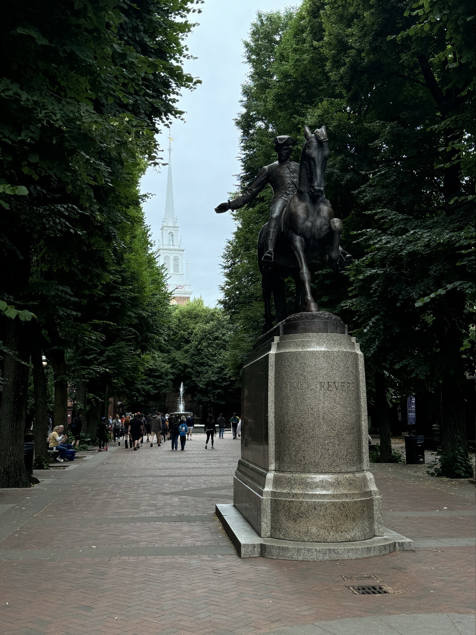
    The Paul Revere Mall with the Old North Church steeple behind it in Boston
    Treat the Freedom Trail as a loose line through the old city, not a homework assignment.

    Faneuil Hall Marketplace is the market hall and surrounding pedestrian blocks near the waterfront, a stop on the Freedom Trail and a working food hall. It is useful as a landmark and an easy food fallback, but I would treat it as part of a walk rather than the entire plan.

    From there, keep moving on foot: Government Center, the North End, the Paul Revere Mall, Old North Church, and the harbor form a compact route that does not need a car.

    Transit notes

    The MBTA Subway is the practical T layer when walking is not enough: Blue Line for Logan Airport via shuttle, Red for Cambridge and South Station, Orange for Back Bay and North Station, and Green for Fenway, Brookline, BU, BC, and the museum side.

    For the old-city route, I would still walk first. Use the T for the cross-town moves, not as the whole itinerary.
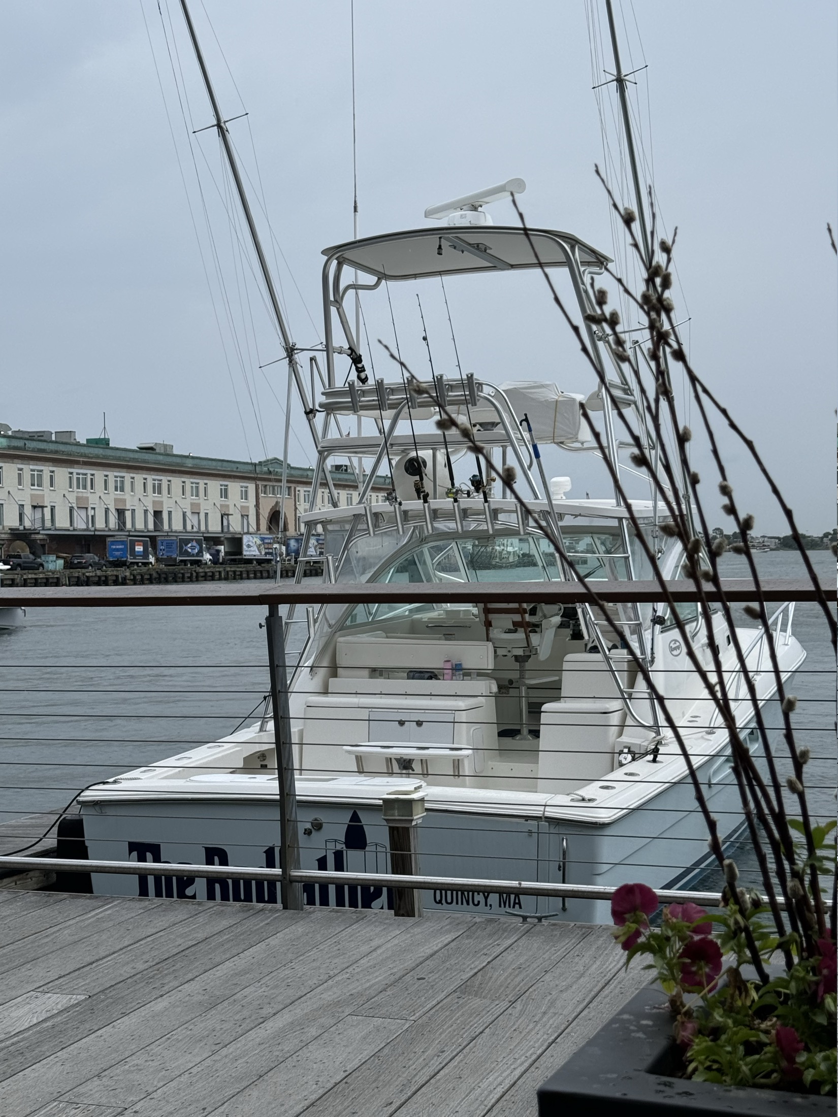
    Boats tied up along Boston Harbor near the Seaport
    The harbor is the easy pressure release after the brick lanes and market crowds: a short walk, wider air, and a clean reset before dinner.

    I would start around the market, cut toward the North End and Old North Church, then finish on the harbor instead of doubling back through downtown traffic.

    Details and sources →

    On this page

    • What's on this list
    • Transit notes