🗂️Guides🏙️Cities📮Pins🌍Countries🚇Getting Around📍My lists😻Cats📖About
Everything else
🏠Home🔐Privacy & data📜Terms of use🧾Sources & credits⛷️Cat-Ski↗ (opens in a new tab)👤Whisker Leaks↗ (opens in a new tab)
🗂️Guides🏙️Cities📮Pins🌍Countries🚇Getting Around📍My lists😻Cats📖About
Everything else
🏠Home🔐Privacy & data📜Terms of use🧾Sources & credits⛷️Cat-Ski↗ (opens in a new tab)👤Whisker Leaks↗ (opens in a new tab)
PostcardsMapTableStats

Plan Cambridge

Current conditions and the practical reference material that helps turn the saved places into a trip.

The next week in Cambridge

7-day forecast from Open-Meteo. UV badges flag days when sun protection matters (3 and above is moderate; 8 and above is risk territory for unprotected fair skin within 30 minutes).

Today
Overcast
31° / 18°
UV Moderate
Wed
Overcast
25° / 18°
UV Moderate
Thu
Overcast
21° / 15°
UV Moderate
Fri
Overcast
22° / 12°
UV Moderate
Sat
Overcast
26° / 16°
UV Moderate
Sun
Overcast
23° / 18°
UV High
Mon
Overcast
22° / 13°
UV High

Climate

Summer (Jun-Sep)

Typical highs around 21°C, lows around 11°C.

Winter (Nov-Mar)

Typical highs around 8°C, lows around 2°C.

In August 4

Drag to scrub across the year.

JFMAMJJASOND
Weather
22° / 12°
Typical high / low
2 mm rainfall this month
Daylight
14.8h
05:41 – 20:27local
Holidays coming up

Public holidays from Nager.Date.

Airports

closest STN · 35 km

Getting around Cambridge

Public-transit operators within 8 km of the city center. Click through to each operator’s site for routes, fares, and tickets.

Local transit operators
Stagecoach EastDews CoachesWhippet CoachesVectareStar CabsStephensons of EssexFlixBus-euFlixbusA2B Bus and CoachNational ExpressC G Myall & Son

About Cambridge

Cambridge is a city and non-metropolitan district in the county of Cambridgeshire, England. It is the county town of Cambridgeshire and is located on the River Cam, 55 miles (89 km) north of London. As of the 2021 United Kingdom census, the population of the City of Cambridge was 145,700; the population of the wider built-up area was 181,137. There is archaeological evidence of settlement in the area dating back to as early as the Bronze Age, and Cambridge became an important trading centre during the Roman and Viking eras. The first town charters were granted in the 12th century, although modern city status was not officially conferred until 1951.

Area
41 km²
Demonym
Cantabrigian
Airport codes
CBG
England basics →Country context, advisories, and entry links for the practicalities shown above.
References5▾▴

The links below support the changing or licensed reference material on this page. Personal notes and ordinary geographic facts are not footnoted individually.

  1. City background. Wikipedia summary may be clipped or paraphrased. Structured fields are cross-checked against the related references.
JFMAMJJASOND25°-2°
highlowrainfallcomfortable months

Monthly highs, lows, rainfall — long-term averages, NASA POWER.

East Midlands Railway
CrossCountry
Great Northern
Thameslink
Greater Anglia

Operators and modes are aggregated from individual transit-agency GTFS feeds. Route classifications come from each feed’s route type codes.

Related: Wikidata, Open-Elevation, IANA Time Zone Database, CC BY-SA 4.0.
  • Weather and climate. Seven-day forecast and long-term monthly climate for the city coordinates. Related: NASA POWER, Open-Meteo license.
  • Getting around. Transit operators from agency GTFS feeds and nearby commercial-airport reference data. Related: OurAirports.
  • Public holidays. Upcoming public-holiday dates used in the annual planning scrubber.
  • City flag source. CC BY-SA 3.0, Qpwoeizmxn.
  • Maps, image licenses, and the full dataset registry are listed in site credits.

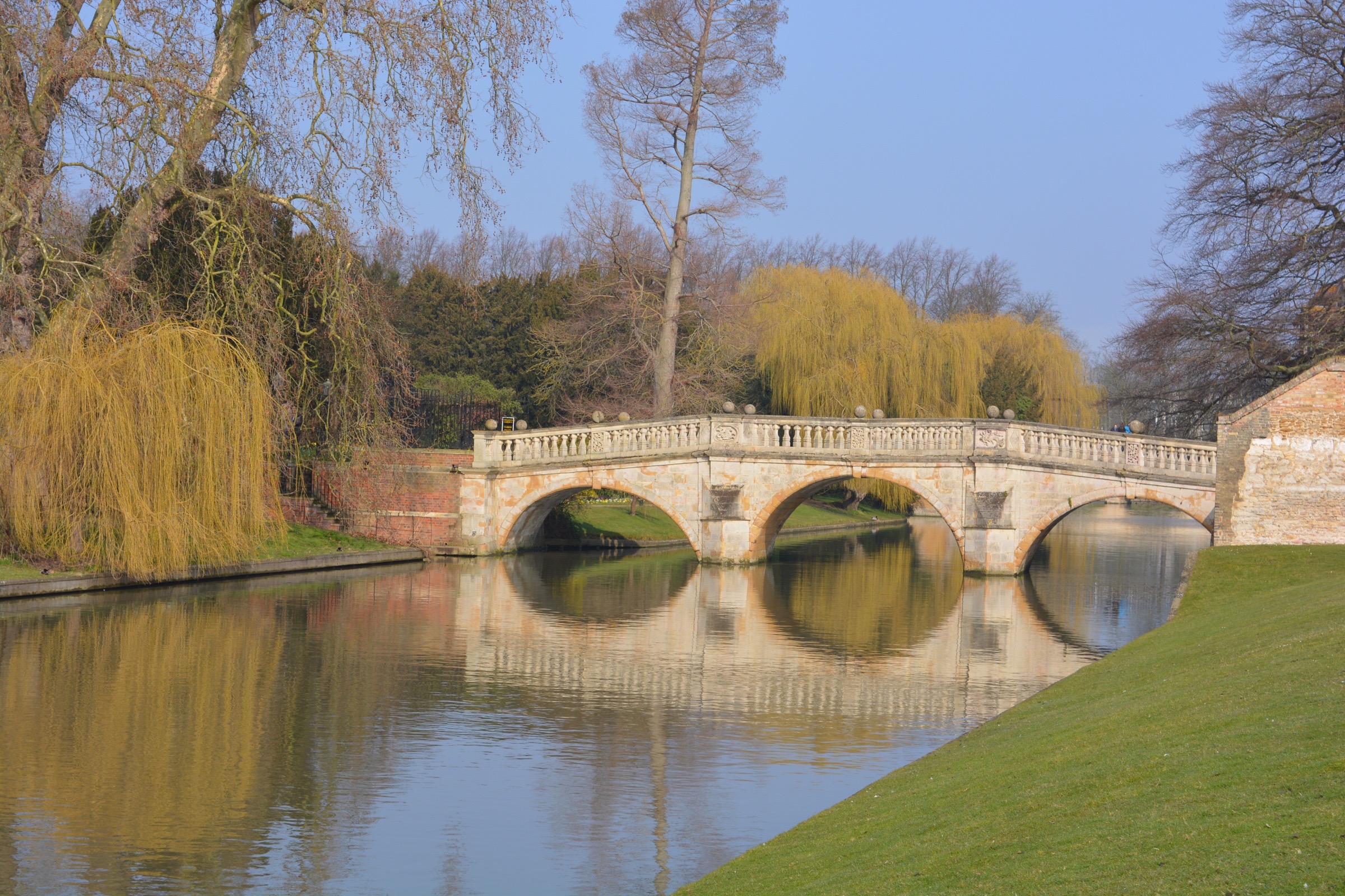
    The River Cam and a stone bridge in Cambridge.
    Cities›England›Cambridge

    Cambridge is a walking city built around the colleges

    A compact Cambridge guide to the colleges, the Backs, the River Cam, and the two food stops on my map.

    Updated
    Jul 24, 2026
    📍View my pins on Google↗◎Things to do in Cambridge→
    BeenCfa📍2 places

    Cambridge at a glance

    Local time   · Europe/London
    Today
    Overcast31° / 18°
    Travel basics
    Tap water
    Safe to drink
    Electricity
    230 V / 50 Hz · Type G
    Drives on
    Left
    Currency
    British pound sterling (GBP)
    Language
    English
    US passport
    eVisa

    Entry rules change. Verify current requirements before booking.

    City context
    Population
    124K
    Elevation
    6 m
    Climate
    Cfa
    Founded
    1 AD
    England

    Cambridge makes sense on foot. The colleges fill the center, the River Cam runs behind them, and the older streets are close enough together that there is no reason to build a complicated route.

    Start around King's Parade and the market, then work north or south through the college streets. The Backs are the green spaces behind the colleges along the river. This is where the familiar Cambridge view comes from: lawns, stone bridges, punts, and college buildings seen from the water.

    Punting is the obvious river activity, either with a guide or on your own. The guided version lets somebody else handle the pole while explaining which college you are looking at. If you go alone, expect the first few minutes to be less elegant than the photographs.

    Places in Cambridge

    • ◐Arepa's Station
    • ◐The Clarendon Arms

    Eating around the walk

    My Cambridge food map is still short, so these are pins rather than a complete survey of the city.

    Arepa's Station is the casual Venezuelan stop on the list. The Clarendon Arms is the pub, east of the busiest college streets and better suited to sitting down after the river and the center.

    The important thing here is not to let lunch turn into the guide. Cambridge is about the streets, colleges, chapels, and river. The two food pins are simply useful places already on my map.

    Details and sources →