Liverpool starts at the Mersey and works back into the city
My Liverpool guide to the waterfront, St Johns Beacon, the Beatles sites, the two cathedrals, and the food stops I used.
- Updated
- Jul 24, 2026
Current conditions and the practical reference material that helps turn the saved places into a trip.
7-day forecast from Open-Meteo. UV badges flag days when sun protection matters (3 and above is moderate; 8 and above is risk territory for unprotected fair skin within 30 minutes).
Typical highs around 18°C, lows around 12°C.
Typical highs around 7°C, lows around 3°C.
Public holidays from Nager.Date.
Public-transit operators within 8 km of the city center. Click through to each operator’s site for routes, fares, and tickets.
Liverpool is a port city and metropolitan borough in Merseyside, England. It is situated on the eastern side of the Mersey Estuary, near the Irish Sea, 178 miles (286 km) north-west of London. It had a population of 508,961 in 2024 and is the administrative, cultural and economic centre of the Liverpool City Region, a combined authority area with a population of over 1.5 million.
The links below support the changing or licensed reference material on this page. Personal notes and ordinary geographic facts are not footnoted individually.
Monthly highs, lows, rainfall — long-term averages, NASA POWER.
Operators and modes are aggregated from individual transit-agency GTFS feeds. Route classifications come from each feed’s route type codes.
Maps, image licenses, and the full dataset registry are listed in site credits.
My Liverpool guide to the waterfront, St Johns Beacon, the Beatles sites, the two cathedrals, and the food stops I used.
Liverpool faces the Mersey. Start there, with the Pier Head and the old dock buildings, then walk uphill into the commercial center, Ropewalks, and the two cathedrals. The Beatles are part of the city, but they make more sense after seeing the port that produced it.
Planning brief
Liverpool is a port city on the Mersey in northwest England. The Pier Head and Royal Albert Dock form the waterfront. The commercial center and Ropewalks rise behind them, with the two cathedrals farther uphill.
The Pier Head, Three Graces, Royal Albert Dock, and dock museums explain Liverpool as a port before the Beatles material begins.
Mathew Street is the quick city-center version. Penny Lane, Strawberry Field, and the childhood homes require a route into the southern suburbs.
The Anglican and Metropolitan cathedrals face each other from opposite ends of Hope Street. Their scale and architecture could hardly be more different.
The waterfront, center, Ropewalks, and cathedrals fit into one walking area. Merseyrail becomes useful for places beyond it.
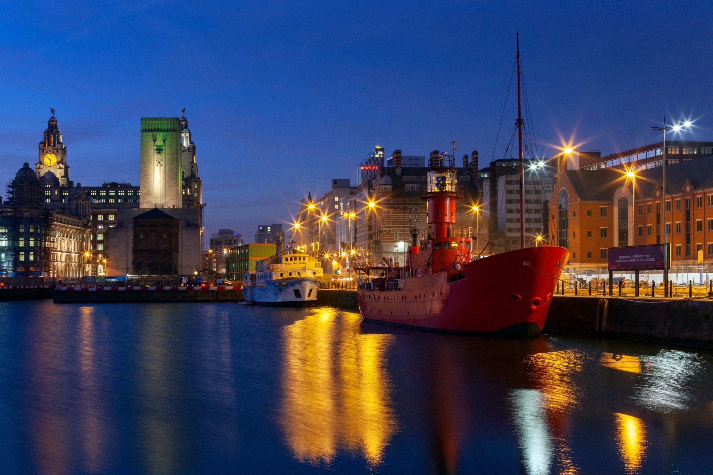
At the Pier Head, the Royal Liver Building, Cunard Building, and Port of Liverpool Building stand together as the Three Graces. South of them, the Royal Albert Dock is a ring of red-brick warehouses around the water. The docks now contain museums, restaurants, and the Beatles Story.
Liverpool's waterfront lost its UNESCO listing in 2021 after years of disagreement over redevelopment. That is part of the modern history of the docks, not a reason to skip them.
For a view over the roofs and river, go up St Johns Beacon, still commonly called Radio City Tower. I paid to go up and was glad I did. From there the shape of the center and the width of the Mersey are much clearer than they are at street level.
The compact version is Mathew Street, where the rebuilt Cavern Club sits among statues, signs, bars, and a steady stream of visitors. It is central and easy to walk through without committing to a tour.
The deeper route heads south to Penny Lane, Strawberry Field, and the childhood homes. The National Trust controls access to the Lennon and McCartney houses, so that part needs proper planning. These are suburban places rather than a continuation of Mathew Street.
Liverpool Cathedral is the enormous Anglican building at one end of Hope Street. The Metropolitan Cathedral is the circular modernist Catholic building at the other. Walking between them takes you through a different Liverpool from the docks, with Georgian streets, university buildings, pubs, and restaurants.
The pair is more interesting than choosing which cathedral is the important one. One is dark sandstone and monumental. The other pulls colored light through a lantern above the circular interior.

Olive Branch on Church Street was a great counter-service stop. The shawarma was very tasty and worked when I wanted food without turning it into a long meal.
Duke Street Food & Drink Market was absolutely happening on a Saturday morning. It is a food hall rather than one restaurant, so it works well when nobody in a group wants the same thing.
AKA Sushi had a very chill atmosphere when I went. At Duman on Bold Street, I sat outside with cake on an impressively grey Liverpool day.
The rest of the map includes Renshaw Street Food Market, Etsu, Pho, The Italian Club Fish, The Grapes, The Swan Inn, and ArCains. I have not written personal notes for all of them, so treat those as saved places to investigate rather than a ranked list.
Central Liverpool is a walking city. Lime Street station, St Johns Beacon, the waterfront, Ropewalks, and the cathedrals all sit within the same central area.
Merseyrail is the layer for places beyond it, including the Wirral, Crosby, Southport, and the coast. Liverpool John Lennon Airport is reached by road and bus rather than a direct airport railway station.


