Brighton runs downhill from the station to the sea
My Brighton guide to the Palace Pier arcade, Royal Pavilion, the Lanes, the pebble beach, and a cheap shellfish stop by the water.
- Updated
- Jul 24, 2026
Current conditions and the practical reference material that helps turn the saved places into a trip.
7-day forecast from Open-Meteo. UV badges flag days when sun protection matters (3 and above is moderate; 8 and above is risk territory for unprotected fair skin within 30 minutes).
Typical highs around 20°C, lows around 12°C.
Typical highs around 8°C, lows around 3°C.
Public holidays from Nager.Date.
Public-transit operators within 8 km of the city center. Click through to each operator’s site for routes, fares, and tickets.
Brighton is a seaside resort in the unitary authority area of Brighton and Hove, in East Sussex, England, 47 miles (76 km) south of London. Archaeological evidence of settlement in the area dates back to the Bronze Age, Roman and Anglo-Saxon periods. The ancient settlement of "Brighthelmstone" was documented in the Domesday Book (1086). The town's importance grew in the Middle Ages as the Old Town developed, but it languished in the early modern period, affected by foreign attacks, storms, a suffering economy and a declining population. Brighton began to attract more visitors following improved road transport to London and becoming a boarding point for boats travelling to France. The town also developed in popularity as a health resort for sea bathing as a purported cure for illnesses.
The links below support the changing or licensed reference material on this page. Personal notes and ordinary geographic facts are not footnoted individually.
Monthly highs, lows, rainfall — long-term averages, NASA POWER.
Operators and modes are aggregated from individual transit-agency GTFS feeds. Route classifications come from each feed’s route type codes.
Maps, image licenses, and the full dataset registry are listed in site credits.
My Brighton guide to the Palace Pier arcade, Royal Pavilion, the Lanes, the pebble beach, and a cheap shellfish stop by the water.
Brighton is a straight line downhill from the railway station to the Channel, but it does not feel like one attraction after another. The Royal Pavilion interrupts the center with domes and minarets, the Lanes compress into old shopping alleys, and the whole city then opens onto a wide pebble beach.
Planning brief
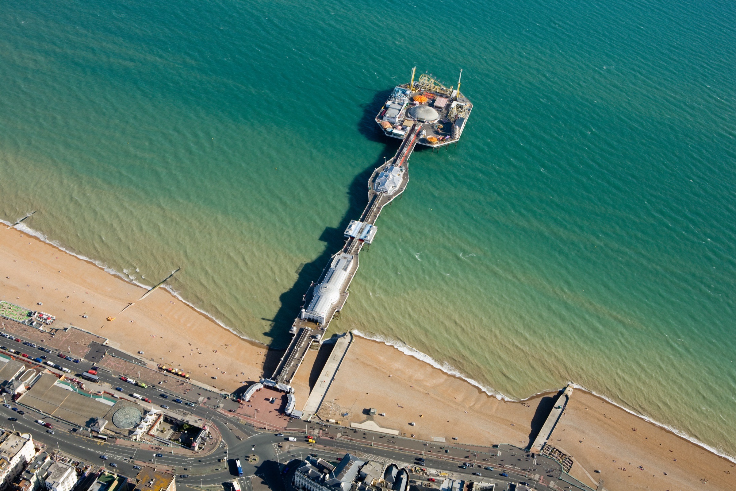
Brighton slopes from the railway station down to the Channel. The Royal Pavilion and the Lanes sit between the tracks and the sea. The Palace Pier, beach, and old West Pier ruins line up along the promenade.
It is easy to follow the crowd downhill from Brighton station to the sea. Leave enough energy for the climb back to the platforms.
The machines are old and some barely work, but the Palace of Fun entertained me while removing only a small amount of cash.
George IV's domes and minarets look improbable from the gardens and become even stranger inside.
The historic Lanes are the tight shopping alleys near the Pavilion. North Laine is the larger grid of independent shops and cafes north of it.
Brighton Palace Pier is the working pleasure pier east of the center. It has rides at the far end and the Palace of Fun arcade under cover.
The machines are older and many do not work particularly well. That did not bother me. The job of a pier arcade is to separate me from a small amount of cash while keeping me entertained, and it completed the job. I am still salty that the dump levers on the little trucks in one penny machine were defective.
That is the Brighton detail I remember better than a polished description of the sea air. The pier is slightly worn, inexpensive fun over the water.
Brighton's central beach is shingle. Walking across the rounded stones is awkward, and sitting on them is its own technique. The promenade is easier and continues in both directions past bars, old arches, and beach businesses.
West of the center, the skeletal remains of the West Pier stand offshore. The pier burned and collapsed years ago, leaving an iron frame that changes with the tide and light. The Brighton i360 viewing tower stands on the promenade nearby.
Volk's Electric Railway runs along the eastern seafront when in season. It is a small piece of working transport history and a more Brighton way to move along the shore than calling a car.

The Royal Pavilion began as George IV's seaside retreat and was expanded into the building now in the center of Brighton. Its domes and minarets are already unusual from Pavilion Gardens. Inside, the rooms push the decoration much further.
The gardens are open space around the palace and useful even when you are not going inside. From there, the Lanes begin as a compact network of narrow alleys, small shops, jewelry stores, pubs, and restaurants.
North Laine is a different area, despite the confusingly similar name. It spreads north from the Pavilion toward the station with independent shops, cafes, street art, and a less compressed street grid. Moving through both is the natural route back uphill.
Brighton Shellfish & Oyster Bar is my cheap seafood stop on the water. It is informal and makes sense as part of the seafront rather than a destination meal.
The rest of my saved map includes Happy Maki, Petit Pois, Pho, Bison Beer, and Brighton Music Hall. I have not written detailed personal notes for those, so I would check current menus and reviews before treating the pins as recommendations.
Trains from London arrive above the center. From the station, walk downhill toward the Pavilion and continue to the sea. That route is simple enough that Brighton does not need a complicated transit plan.
Remember the slope when returning. The walk from the seafront to the station looks short on a map and feels longer with luggage or after spending hours on the shingle.
