-13.1631, -72.5450
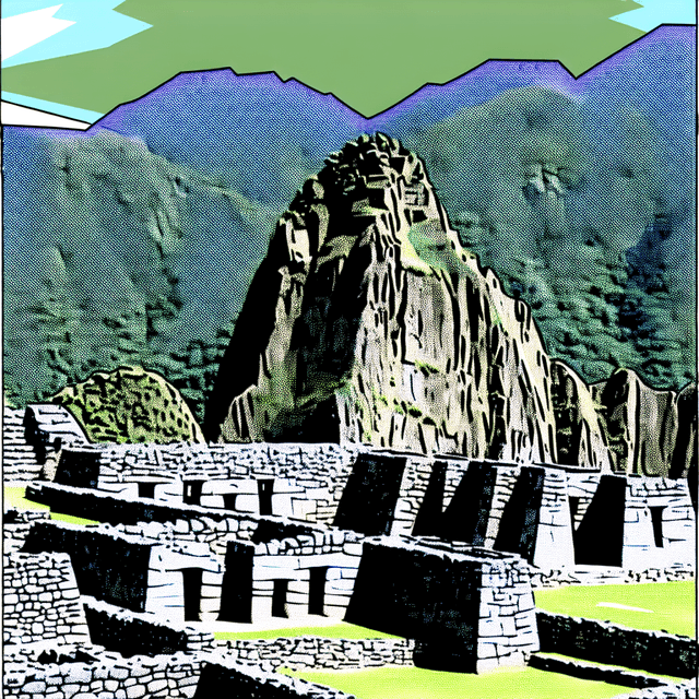
Qhapaq Ñan, Andean Road System
Cusco, Argentina, Bolivia, Chile, Colombia, Ecuador, Peru
From the source
This site is an extensive Inca communication, trade and defence network of roads covering 30,000 km. Constructed by the Incas over several centuries and partly based on pre-Inca infrastructure, this extraordinary network through one of the world’s most extreme geographical terrains linked the snow-capped peaks of the Andes – at an altitude of more than 6,000 m – to the coast, running through hot rainforests, fertile valleys and absolute deserts. It reached its maximum expansion in the 15th century, when it spread across the length and breadth of the Andes. The Qhapac Ñan, Andean Road System includes 273 component sites spread over more than 6,000 km that were selected to highlight the social, political, architectural and engineering achievements of the network, along with its associated infrastructure for trade, accommodation and storage, as well as sites of religious significance.
Plan your visit
Features & amenities
What to expect
More near here
Other pins within walking distance of Qhapaq Ñan, Andean Road System.