Eastbourne is a Victorian seafront at the foot of the South Downs
My Eastbourne guide to the pier and seafront, the walk toward Beachy Head, the Grand Hotel, and the places I used in town.
- Updated
- Jul 24, 2026
Current conditions and the practical reference material that helps turn the saved places into a trip.
7-day forecast from Open-Meteo. UV badges flag days when sun protection matters (3 and above is moderate; 8 and above is risk territory for unprotected fair skin within 30 minutes).
Typical highs around 20°C, lows around 12°C.
Typical highs around 8°C, lows around 3°C.
Public holidays from Nager.Date.
Public-transit operators within 8 km of the city center. Click through to each operator’s site for routes, fares, and tickets.
Operators and modes are aggregated from individual transit-agency GTFS feeds. Route classifications come from each feed’s route type codes.
Eastbourne is a town and seaside resort in the East Sussex county of South East England, 19 miles (31 km) east of Brighton and 54 miles (87 km) south of London. It is also a local government district with borough status. Eastbourne is immediately east of Beachy Head, the highest chalk sea cliff in Great Britain and part of the larger Eastbourne Downland Estate.
The links below support the changing or licensed reference material on this page. Personal notes and ordinary geographic facts are not footnoted individually.
Monthly highs, lows, rainfall — long-term averages, NASA POWER.
Maps, image licenses, and the full dataset registry are listed in site credits.
My Eastbourne guide to the pier and seafront, the walk toward Beachy Head, the Grand Hotel, and the places I used in town.
I remember Eastbourne in March, with the pier in clear morning light and very little between the promenade and the horizon. It is a traditional English resort: shingle beach, bandstand, large seafront hotels, and a town center immediately behind them. At the western end, the buildings stop and the South Downs climb toward Beachy Head.
Planning brief
Eastbourne has a long shingle seafront, a Victorian pier, and the South Downs rising at the western end of town. The station, center, and promenade are close together. Beachy Head is the walk beyond them.
The promenade joins the pier, bandstand, hotels, and the start of the climb toward the Downs. It is the simplest way to understand the town.
Beachy Head and the Seven Sisters are exposed chalk cliffs, not a fenced viewpoint. Check the weather and stay well back from the edge.
I stayed in the large white Victorian hotel on the western seafront. The building, breakfast room, and leisure facilities feel like the resort Eastbourne was built to be.
Eastbourne station is behind the seafront in the town center. The promenade is an easy walk from the platforms.
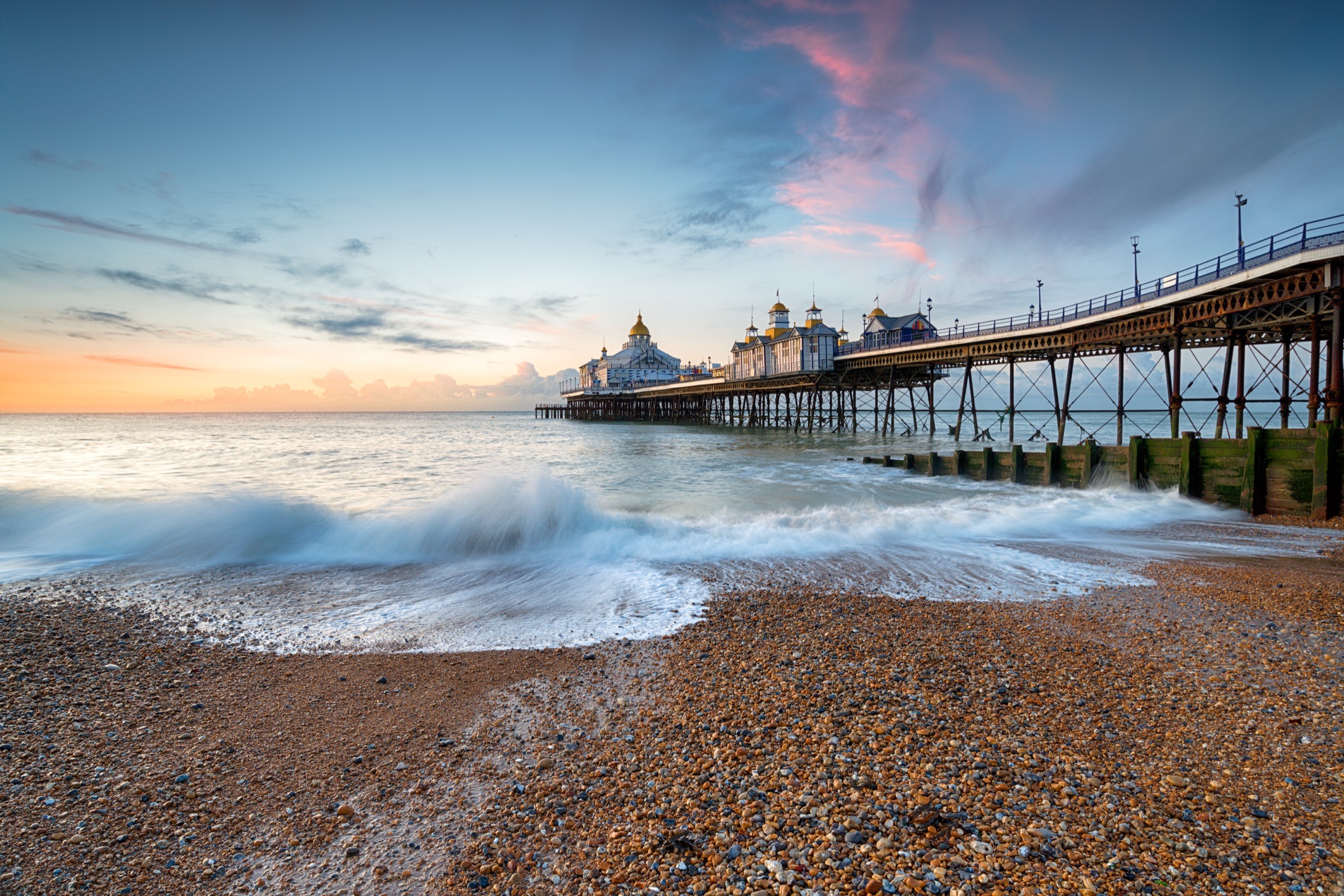
Eastbourne Pier is the obvious marker in the middle of the promenade. It opened in the 19th century and still carries the domed silhouette of a Victorian pleasure pier. I caught it on a gorgeous March morning.
The Eastbourne Seafront is the route rather than a single sight. Walk west from the pier past the bandstand and the old hotels and you eventually reach the greener end of town below the Downs. There was renovation work along parts of the front when I was there in 2024, so the experience may look tidier now than it does in some of my photographs.
The Towner is just inland from the western seafront. It is Eastbourne's contemporary-art gallery, in a building wrapped in a large geometric mural.
The ground rises quickly beyond the seafront. Beachy Head is the first major headland, with the red-and-white lighthouse below the cliff. Farther west, the Seven Sisters form the repeated line of white chalk faces toward the Cuckmere.
This is open downland with an unfenced, eroding edge. You can see the coast without walking near the drop. Weather also changes quickly on the exposed ridge, so the forecast matters more here than it does on the promenade.
I stayed at the Grand Hotel with my brother before driving on for the Romney, Hythe and Dymchurch Railway. The hotel is the big white Victorian building near the western end of the seafront. It has the breakfast room, spa, and leisure facilities you would expect from an old resort hotel, and it was a quiet base for us.
It is not a practical base for that railway without a car. I mention it because it explains why we were in Eastbourne and because the building is very much part of the town, not because it solves transport elsewhere along the coast.
At Bistrot Pierre, I arrived after walking more than 20 miles and asked for the biggest water they could bring me. They did, which made me disproportionately happy.
The rest of my saved food map is thinner: 1912 Restaurant, Kostas Greek Souvlaki, Sabaidee Thai Restaurant, and Thai & Vietnamese Street Food. Those are map pins, not personal endorsements, so check their current details before going.