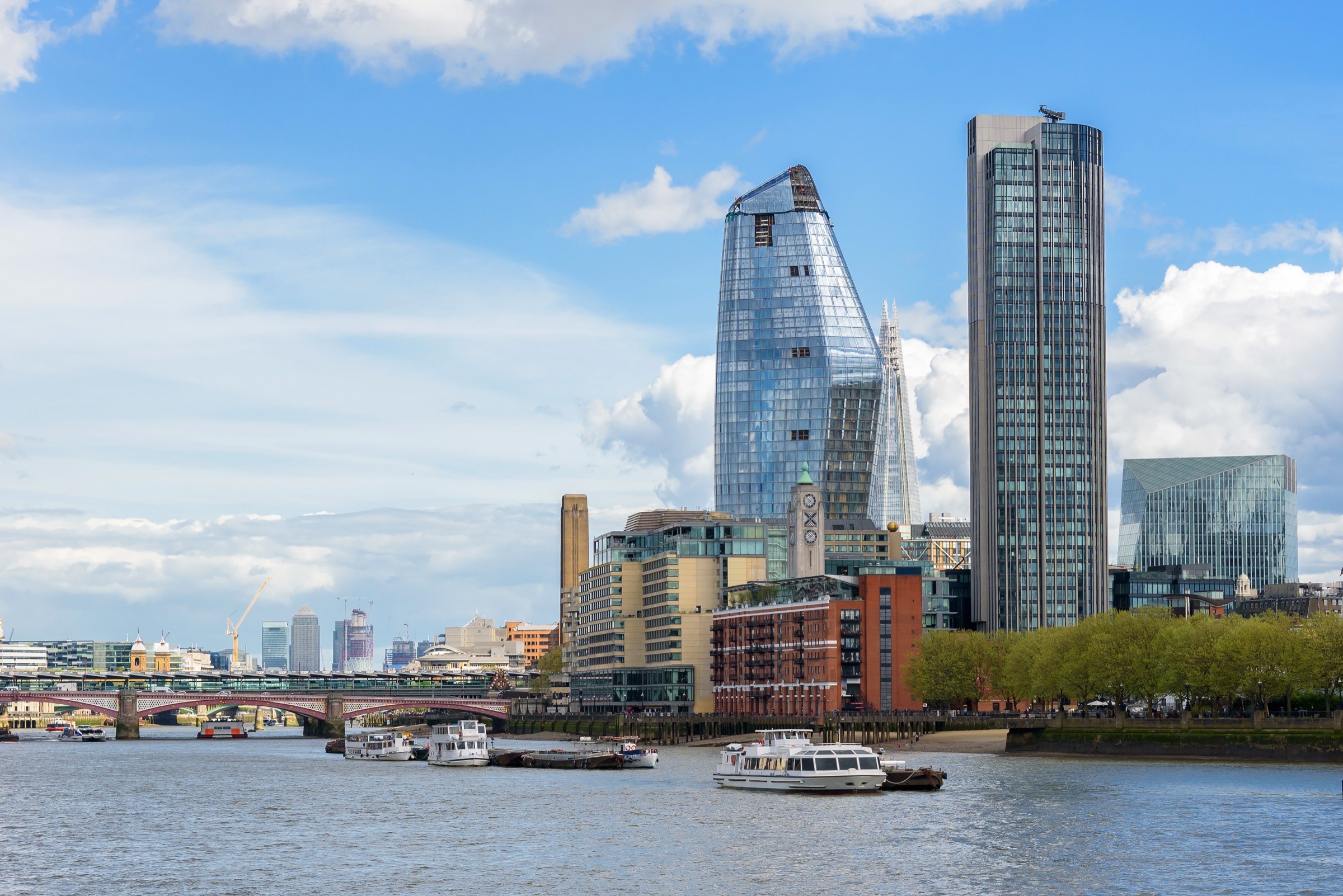
Pick & Cheese - The Cheese Bar - Covent Gardenrestaurant
+8
citizenM Tower of Londonhotel
+4
Tower Hillattraction
Shoreditch High Street Stationtransit
+2
Four Points Flex by Sheraton London Shoreditch Easthotel
+1
Protein Studios Shoreditchattraction
London Heathrow Airporttransit
+4
St Katharine Docksattraction
+4
Hyatt Place London City Easthotel
Pret A Manger Old Broad Streetrestaurant
Pret A Manger Bishopsgaterestaurant
+5
Andaz London Liverpool Street, by Hyatthotel
+3
Sticks'n'Sushi Shoreditchrestaurant
Plan London
Current conditions and the practical reference material that helps turn the saved places into a trip.
The next week in London
7-day forecast from Open-Meteo. UV badges flag days when sun protection matters (3 and above is moderate; 8 and above is risk territory for unprotected fair skin within 30 minutes).
Today
Overcast
29° / 20°
UV Moderate
Wed
Overcast
25° / 18°
UV Moderate
Thu
Overcast
22° / 15°
UV High
Fri
Overcast
22° / 15°
UV High
Sat
Overcast
26° / 17°
UV High
Sun
Overcast
24° / 20°
UV High
Mon
Overcast
23° / 15°
UV High
Climate
Summer (Jun-Sep)
Typical highs around 21°C, lows around 11°C.
Winter (Nov-Mar)
Typical highs around 8°C, lows around 2°C.
In August 4
Drag to scrub across the year.
JFMAMJJASOND
Weather
22° / 12°
Typical high / low
2 mm rainfall this month
Daylight
14.7h
05:44 – 20:26local
Holidays coming up
Public holidays from Nager.Date.
Airports
closest LCY · 13 km
Getting around London
Public-transit operators within 8 km of the city center. Click through to each operator’s site for routes, fares, and tickets.
Local transit operators
Smartbus↗ (opens in a new tab)VectareMetroline TravelRedwing CoachesCentaur CoachesArriva Herts and EssexStagecoach LondonArriva Beds and BucksBerry's CoachesStagecoach Oxfordshire
About London
London is the capital and largest city of England and the United Kingdom, with a population of 9.1 million people in 2024. Its wider metropolitan area is the largest in Western Europe, with a population of 15.1 million. London stands on the River Thames in southeast England, at the head of a 50-mile (80 km) tidal estuary down to the North Sea, and has been a major settlement for nearly 2,000 years. Its ancient core and financial centre, the City of London, was founded by the Romans as Londinium and has retained its medieval boundaries. The City of Westminster, to the west of the City of London, has been the site of the national government and parliament for centuries. London grew rapidly in the 19th century, becoming the world's largest city at the time. Since the 19th century the name "Lo
The links below support the changing or licensed reference material on this page. Personal notes and ordinary geographic facts are not footnoted individually.
highlowrainfallcomfortable months
Monthly highs, lows, rainfall — long-term averages, NASA POWER.
Getting around. Transit operators from agency GTFS feeds and nearby commercial-airport reference data. Related: OurAirports.
Public holidays. Upcoming public-holiday dates used in the annual planning scrubber.
Maps, image licenses, and the full dataset registry are listed in site credits.
How to walk around London like you used to live there
A London-on-foot guide for making the city feel familiar: pick the airport by geography, then use the Tube to set up walks through Bankside, Canary Wharf, Greenwich, Camden, Olympic Park, and the Thames east.
London is easiest to understand on foot. My routes usually follow something visible: the Thames, Regent's Canal, a park edge, a market street, or the old docks. I use the Tube to reach the start, leave when I am tired, or switch to a different side of town.
That is why the hotel and airport advice has to be more flexible than "fly Heathrow, stay central." London has several centers. Canary Wharf is not Soho. Gatwick is not Heathrow. A good plan on the west side can be a bad plan if your meeting is in the Royal Docks.
Planning brief
Planning London
London is easier when you plan by side of town, airport, and walking route. Transit sets up walks along the river, canals, parks, markets, and the old commercial streets between them.
Pick the airport by geography
Heathrow, Gatwick, Stansted, Luton, London City, and Southend all enter London differently. Pick the airport that puts you on the right rail line for where you are staying.
Make walking the plan
Bankside, Regent's Canal, Canary Wharf to Greenwich, Olympic Park to Hackney, and the Thames east are good route anchors. Use transit to start and end the walk.
Use Canary Wharf carefully
For work, ExCeL, or a quiet evening base, Canary Wharf is great. For a first sightseeing trip, stay more central and visit the Wharf as a walk.
Learn the practical chains
Itsu, Greggs, Pret, Flat Iron, and the pub chains are part of practical London. They are not special, but they keep a long day moving.
Pick the airport by side of town. Heathrow is the long-haul default. Gatwick is often better for London Bridge, Bankside, Victoria, south London, or Brighton. London City is fantastic for Canary Wharf, ExCeL, and the City if your route exists. Stansted and Luton can make sense for cheap European flights and the north or northeast side.
Use one contactless card or phone for every ride. Tap in and tap out with the same thing so the daily cap works.
Walk more than you think. Bankside, Regent's Canal, the Thames Path, Olympic Park, Greenwich, and the parks make the city easier to understand.
Canary Wharf works for particular trips. I stay there for work, ExCeL, and the eastern side of the city. The offices empty in the evening, which can be welcome or far too quiet depending on the trip.
Know the chains. Itsu, Greggs, Pret, Flat Iron, and the pub chains are practical tools. Some of London is chain-heavy, so knowing the decent ones helps.
Getting in from the airport
London has six airports, and none is the universal answer. They sit on different sides of the metro area and feed into different rail stations.
Airport
Best for
How it enters London
Main catch
Heathrow
Long-haul flights, west London, Paddington, central London
Elizabeth Line, Piccadilly Line, Heathrow Express
Big airport, not close to the east side
Gatwick
London Bridge, Bankside, Victoria, south London, Brighton
Thameslink, Southern, Gatwick Express
Can be awkward for the Wharf or north London
London City
Canary Wharf, ExCeL, the City, short business routes
DLR into the docks and Bank
Limited route map, often pricier
Stansted
Cheap European flights, northeast London, Liverpool Street
Stansted Express
Far out, and the train can feel long late at night
Luton
Cheap European flights, north London, St Pancras routes
Luton DART plus Thameslink or rail
The airport transfer adds a step
Southend
Niche east-side routes
Rail toward Liverpool Street
Only use it when the flight deal is strong
So the question is not "which London airport is best?" It is "where am I staying, where do I need to be first, and which train lands closest to that?" Gatwick works well for Bankside and London Bridge. Heathrow feeds Paddington and the Elizabeth and Piccadilly lines. London City is the easy choice when the flight exists and the day is in Canary Wharf or ExCeL.
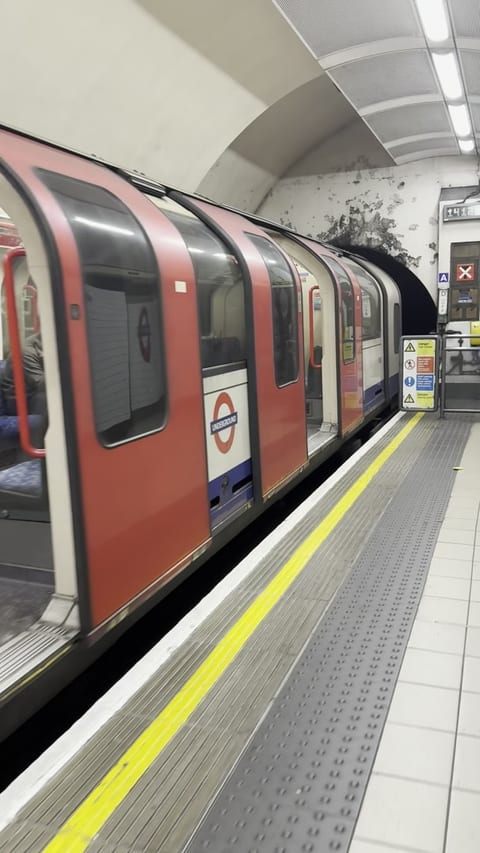
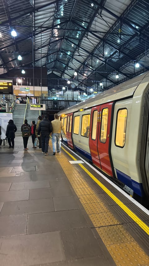
Transport for London runs on contactless tap-to-pay. Pick one card or one phone wallet and use it for every ride. That is how the daily cap works. If you tap in with your phone in the morning and use a physical card after lunch, the system sees two riders.
Tap in and tap out on the Tube, Elizabeth Line, Overground, DLR, and rail. Buses are tap-on only. Do not buy a paper ticket unless you have a specific rail reason. Contactless is the normal visitor setup now.
I keep the fuller route notes on one London Transit page now, because that is how it works as a traveler: Tube, DLR, and Elizabeth Line are different built forms, but they behave like one usable TfL network.
The lines I think about most:
Elizabeth Line. Heathrow, Paddington, Bond Street, Tottenham Court Road, Farringdon, Liverpool Street, Canary Wharf, and Custom House for ExCeL.
Jubilee Line. Westminster, Waterloo, London Bridge, Canary Wharf, and Stratford.
DLR. The fun eastern network. Canary Wharf, Greenwich, London City Airport, Royal Docks, and a useful escape hatch when a walk gets too long.
Piccadilly Line. Heathrow, Earl's Court, South Kensington, Piccadilly Circus, and King's Cross.
The river boats. Pricier than the Tube, but fast and fun, and some have a bar. That counts for something.
Where to stay
Choose the base from the part of London you need most. I use Tower Hill and Liverpool Street for central business stays, Kensington for the museums and Heathrow side, and Canary Wharf, ExCeL, or Stratford when the trip is in east London.
Quick answers
Which London airport should I use?
Pick by route and side of town. Heathrow is the easiest long-haul default. Gatwick can be better for London Bridge, Bankside, Victoria, south London, or Brighton. Stansted works for northeast London and some cheap European flights. Luton works for north London and St Pancras routes. London City is excellent for Canary Wharf, ExCeL, and the City if your route exists.
What is the best first walk in London?
Start at Borough Market, walk west along Bankside past Tate Modern and the Globe, then keep going toward the London Eye. It is obvious, but it works. If you want a less obvious day, walk Canary Wharf to Greenwich through the foot tunnel.
Should I ride the London Eye?
I like it, but queues can be long and admission is expensive. For another high view, book the free Sky Garden at the Walkie Talkie and buy a drink upstairs instead.
Is Canary Wharf a good place to stay?
Yes for work, ExCeL, or if you want quiet evenings and fast transit. No for a first tourist trip where you want to walk out the door into older central London.
How does Brighton connect with London?
Direct trains run from Victoria, London Bridge, and St Pancras toward Brighton. The station is above the center, with the Royal Pavilion and the Lanes on the walk downhill to the sea.
A quieter walk south down the Isle of Dogs: the Wharf towers, the Victorian foot tunnel under the Thames, then out into Greenwich. DLR back, so it stays a one-way walk.
Canary Wharf is one of my favorite London bases for work and the eastern side of the city. The offices empty in the evening and the docks become quiet. I like that on a longer stay. I would not send a first-time visitor there just to be central.
Start at Crossrail Place Roof Garden, the free covered garden above the Elizabeth Line station. From there you can make the walk as short or long as you want.
The food and drink here are mostly practical. Sticks'n'Sushi is the chain dinner I return to. There are also normal London chains like Slug & Lettuce, and that is fine. A chain pub in the Wharf after work is normal for the area. For a group, the hot tub and BBQ boats in the docks need to be booked ahead.
Then walk south through the Isle of Dogs toward Greenwich. The route is not packed with famous sights. You pass the towers, old dock edges, small parks, Mudchute Park and Farm, and The George if it is time for a pint.
The Greenwich Foot Tunnel opened in 1902 so dock workers could cross the Thames without relying on ferries. Walk down the spiral stairs or take the lift, cross beneath the river in the tiled cast-iron tunnel, then come up beside the Cutty Sark.
On the Greenwich side, do the free National Maritime Museum, walk up through Greenwich Park, and look for the deer enclosure if you want the quieter park loop. The DLR runs back from Cutty Sark or Greenwich, so you do not have to walk back.
Bankside and the South Bank
Start at Borough Market and keep the Thames on your right. The next two miles give you the Globe, Tate Modern, Southbank Centre, and the Eye, with several stations when you are ready to stop.
Optional. Sky Garden is the free alternative for a high look across central London.
For a first visit, start at Borough Market and walk west past Tate Modern, Shakespeare's Globe, the river food pop-ups, Southbank Centre, and the London Eye. I still enjoy the market when it is crowded, but check the current schedule if you are going for one trader.
I like the Eye. Queues can be long and admission is expensive. Sky Garden gives you another high look over central London without an admission charge.
If I want to sit down near the market, I go to Lobos Meat and Tapas, the Spanish place next door. Flat Iron Waterloo is useful when I want a simple steak without turning dinner into a project.
You get the skyline, the river, food, and museums without losing access to the Tube when the weather turns.
Covent Garden, Chinatown, and Seven Dials
If it is your first London trip, walk the West End at least once. Start in Chinatown, drift into Leicester Square and Covent Garden, then keep going through the shopping streets and Seven Dials Market.
I have a soft spot for Covent Garden, even though it can be a lot. I would walk it, enjoy the chaos, and leave when the crowd starts costing you patience.
Seven Dials Market is useful because everybody can find something. My favorite expensive-but-fun move nearby is Pick & Cheese, the conveyor-belt cheese restaurant. Have a glass of wine, eat a few plates, then go somewhere else before cheese becomes the whole dinner budget.
There is a Sticks'n'Sushi in this part of town too, but it is cramped and hard to get a table. I would not build the evening around it.
The London Transport Museum is also here. It is paid, but if you like maps, buses, Underground history, station design, or the way public systems become city identity, it belongs on the list.
Camden and the canal walks
Camden Lock east along Regent's Canal to King's Cross: the calmer, greener way in, ending at the old coal yards. West from the lock runs to Regent's Park and Little Venice instead.
Camden Market is touristy, but it still has energy. The newer Hawley Wharf side and the food-court pieces around the back locks have made it easier to wander without feeling trapped in the old market crush.
The better reason to go is the canal. From Camden Lock you can walk west along Regent's Canal toward Regent's Park and Little Venice. That version is calmer and greener. Or walk east toward King's Cross, Coal Drops Yard, and Word On The Water, the bookshop on a narrowboat.
Coal Drops Yard uses the old rail sheds and coal-drop buildings for shops, restaurants, events, and public space. Word On The Water is the narrowboat bookshop nearby.
Stratford, Olympic Park, and Hackney
Another walk I like starts around Stratford, Westfield, and the London Stadium. From there, cut into Queen Elizabeth Olympic Park and follow the water and green space toward Hackney Wick.
The route runs through post-Olympic landscaping, canals, warehouses, new apartments, breweries, studios, and leftover industrial edges. Hackney Bridge is my food and drink stop along the way.
If you keep going, you can connect toward Victoria Park, Regent's Canal, or farther into Hackney. I save this walk for a longer stay after the central routes.
Sky Garden is the free public garden at the top of 20 Fenchurch Street, the Walkie Talkie. Book a timed slot ahead. Go up, get a cider or a drink, and get the high view without buying a London Eye ticket.
From there, walk down toward Tower Bridge. On the south side near the bridge, there is a lawn-bar setup with an excellent look back at the bridge and fairly ordinary food.
The bridge itself is free to approach and photograph. Going inside the towers and upper walkways is the paid part.
If you face the water and turn left, you can keep walking east. The Thames Path eventually pulls you toward Wapping, Canary Wharf, the Royal Docks, ExCeL, and the engineering side of London. Or you can hop on the Uber Boat. It is not cheap compared with the Tube, but it is fast and fun, and some boats have an onboard bar.
For the infrastructure version of the day, keep the Thames Barrier in mind. It is one of those big engineering works that is more interesting in person than it sounds on paper. The IFS Cloud Cable Car across the Thames is also fun, especially if you are making a loop between Canary Wharf, Greenwich, the Royal Docks, and ExCeL.
Crossness Pumping Station is open only on selected days. The restored Victorian beam engines and decorated ironwork justify the trip when the calendar lines up, but this is a planned outing rather than a casual stop.
Southwest of the center, Battersea Power Station is another piece of infrastructure turned into public space. The building from the Pink Floyd Animals cover now contains shops, food, and offices. The reuse is surreal and very polished. I often end up at its LEGO Store because it is calmer than the central London branches.
Museums and transport-nerd days
The British Museum, Tate Modern, the V&A, the Natural History Museum, and the Science Museum can each absorb most of a day. I choose one or two rather than rush through all of them.
Imperial War Museum is the museum I would add to that group. Its strongest galleries are about what war does to people and societies, not only weapons and campaigns. A friend left one visit saying it felt more like a museum about the impact of war, which is a better description of the experience.
I keep recommending Royal Air Force Museum London in Colindale. It is free, usually calmer than the central museums, and reachable on the Northern line. The hangars hold a Lancaster, Battle of Britain aircraft, Cold War jets, and far more than you can see in a quick hour.
The London Transport Museum in Covent Garden covers Tube maps, buses, signage, station design, and the growth of the network. It is paid, unlike many of the national museums, but I always make room for it.
For beer people, check CAMRA, the Campaign for Real Ale, before you go. Their events can be wonderfully specific: beer festivals, pub crawls, tastings, and sometimes heritage railway days. I went to an Epping Ongar railway event once and it was exactly my kind of strange.
Where to eat
Everywhere I have saved in London, from proper dinners to practical chains. Filter by price or cuisine, or sort by what I rate highest.
Brighton is directly connected with London by trains from Victoria, London Bridge, and St Pancras. From the station, walk downhill through the North Laine and the Lanes toward the Royal Pavilion, Palace Pier, and the sea.
My Brighton guide covers the pier arcade, shingle beach, Royal Pavilion, and the cheap shellfish stop I use by the water.



 +2
+2 +1
+1 +1
+1 +8
+8 +4
+4
 +2
+2 +1
+1
 +4
+4 +4
+4

 +5
+5 +3
+3